Tracking Wildfire Risk From Space
Friday, 04 October 2013 | by Pat's Picks
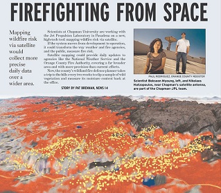
The Orange County Register say satellite technology may soon be put to use to assess wildfire risk. Fire officials in wildfire prone areas currently determine risk by clipping dry vegetation every two weeks and measuring how much moisture they hold. Once the satellite technology is up and running, homeowners would be able to plug their address into a website to find out fire danger levels in their area.
SOURCE: Orange County Register